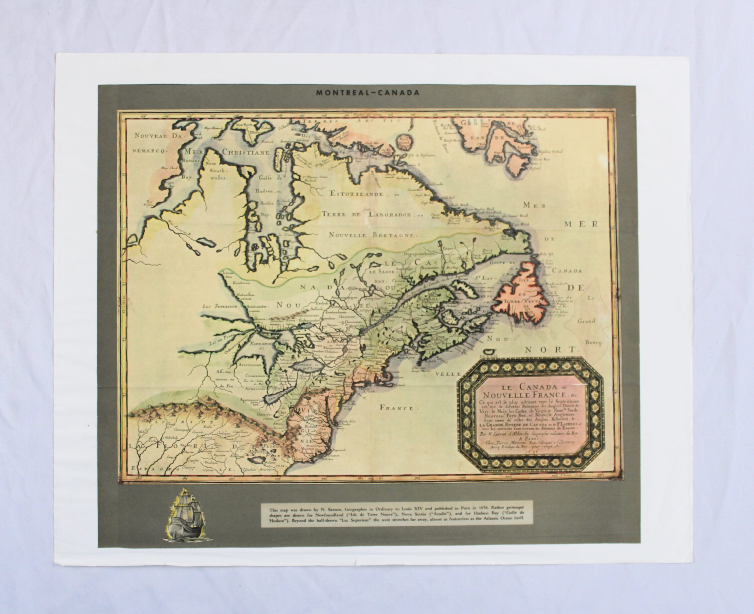
Reproduction of a 17th-century engraved map titled « Le Canada ou Nouvelle France, » attributed to N. Sanson, Geographer in Ordinary to Louis XIV, published in Paris, with a date of 1656 noted in the cartouche. Printed header text reads « MONTREAL-CANADA. » The map covers a broad sweep of northeastern North America, from Hudson Bay and Labrador in the north down through Nouvelle France, Acadie, New England, Virginia, and Florida in the south, with Newfoundland (« Isle de Terre Neuve ») shown in an exaggerated, rounded form. A decorative octagonal title cartouche appears in the lower right, bordered with a wreath-like ornamental frame.
A printed caption panel beneath the map explains that it was drawn by N. Sanson and published in Paris in 1656, noting the somewhat inaccurate (« rather grotesque ») shapes given to Newfoundland, Nova Scotia, and Hudson Bay, and that the geography becomes increasingly vague and undetailed toward the west. As with 2025.049.1, this framing text and format indicate a modern reproduction rather than a period original.
